°M
NM
NM
hh:mm
hh:mm
Procedure
ft/kts/angle
MHz/kHz/Cha.
NM
°T
lbs
gal
°M/kts
kts
ft
ft
Ident/Freq./Dist./Bearing
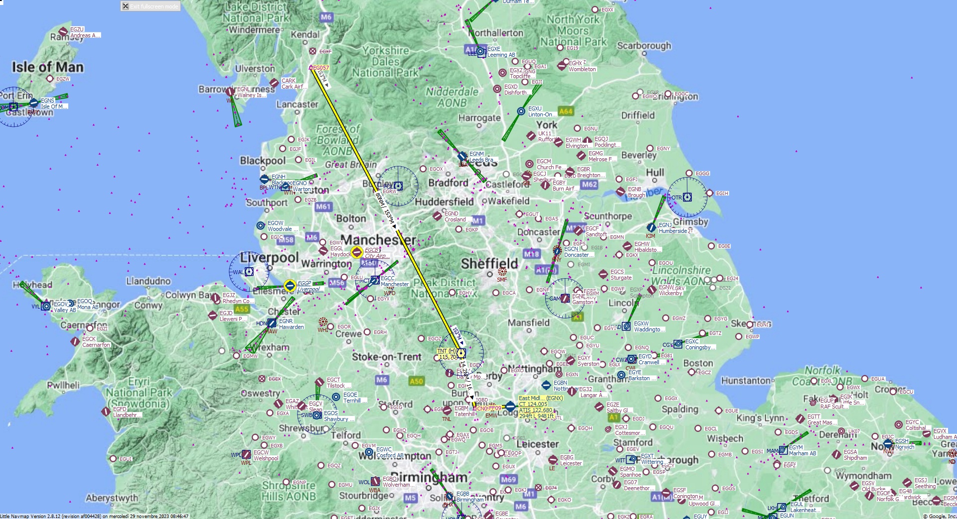
Cruising altitude 31.000 ft.
Distance 103 NM.
Clearance: British 7 4 7 heavy, you are cleared for East Midlands runway 09 approach. Fly heading 1 5 3 direct to TNT VOR. On top Trent VOR, fly outbound heading 1 6 6 to CN09 Fix. Descend and maintain flight level 3 1 0.
Flight Plan Remarks
| FS Approaches UK Airports EGNX - East Midlands Aircraft: Boeing 747-8 City: Nottingham Elevation: 294 ft Magnetic declination: 0,2° West Runway 09 Size: 9.481 x 139 ft Surface: Bituminous Pattern Altitude: 1.000 ft Edge Lights: High Center Lights: Low Runway Markings: Edges, Threshold, Fixed Distance, Touchdown, Dashes, Ident, Precision, Alternate Touchdown |
| Ident | Name | Course °M |
Distance NM |
Remarks | Remaining NM |
Leg Time hh:mm |
Procedure | ETA hh:mm |
Region | Airway or Procedure |
Restriction ft/kts/angle |
Type | Freq. MHz/kHz/Cha. |
Range NM |
Course °T |
Fuel Rem. lbs |
Fuel Rem. gal |
Wind °M/kts |
Head- or Tailwind kts |
Altitude ft |
Leg Safe Alt. ft |
Latitude | Longitude | Related Ident/Freq./Dist./Bearing |
|
|---|---|---|---|---|---|---|---|---|---|---|---|---|---|---|---|---|---|---|---|---|---|---|---|---|---|
| EG057 | 0,0 | 103 | Departure | EG | 54° 13' 40,01" N | 2° 42' 22,02" W | |||||||||||||||||||
| TNT | Trent | 153 | 80 | 23 | EG | VORDME (H) | 115,70 | 195 | 152 | 53° 3' 14,22" N | 1° 40' 11,88" W | ||||||||||||||
| CN09 | 166 | 14,2 | 8,9 | EG | 165 | 52° 49' 31,03" N | 1° 34' 19,33" W | ||||||||||||||||||
| FF09 | 88 | 3,0 | 5,9 | EG | 88 | 52° 49' 38,71" N | 1° 29' 22,87" W | ||||||||||||||||||
| EGNX | East Midlands | 88 | 5,9 | 747 | 0,0 | Destination | EG | 88 | 52° 49' 52,00" N | 1° 19' 39,99" W |
| Links |