°M
NM
NM
hh:mm
hh:mm
Procedure
ft/kts/angle
MHz/kHz/Cha.
NM
°T
lbs
gal
°M/kts
kts
ft
ft
Ident/Freq./Dist./Bearing
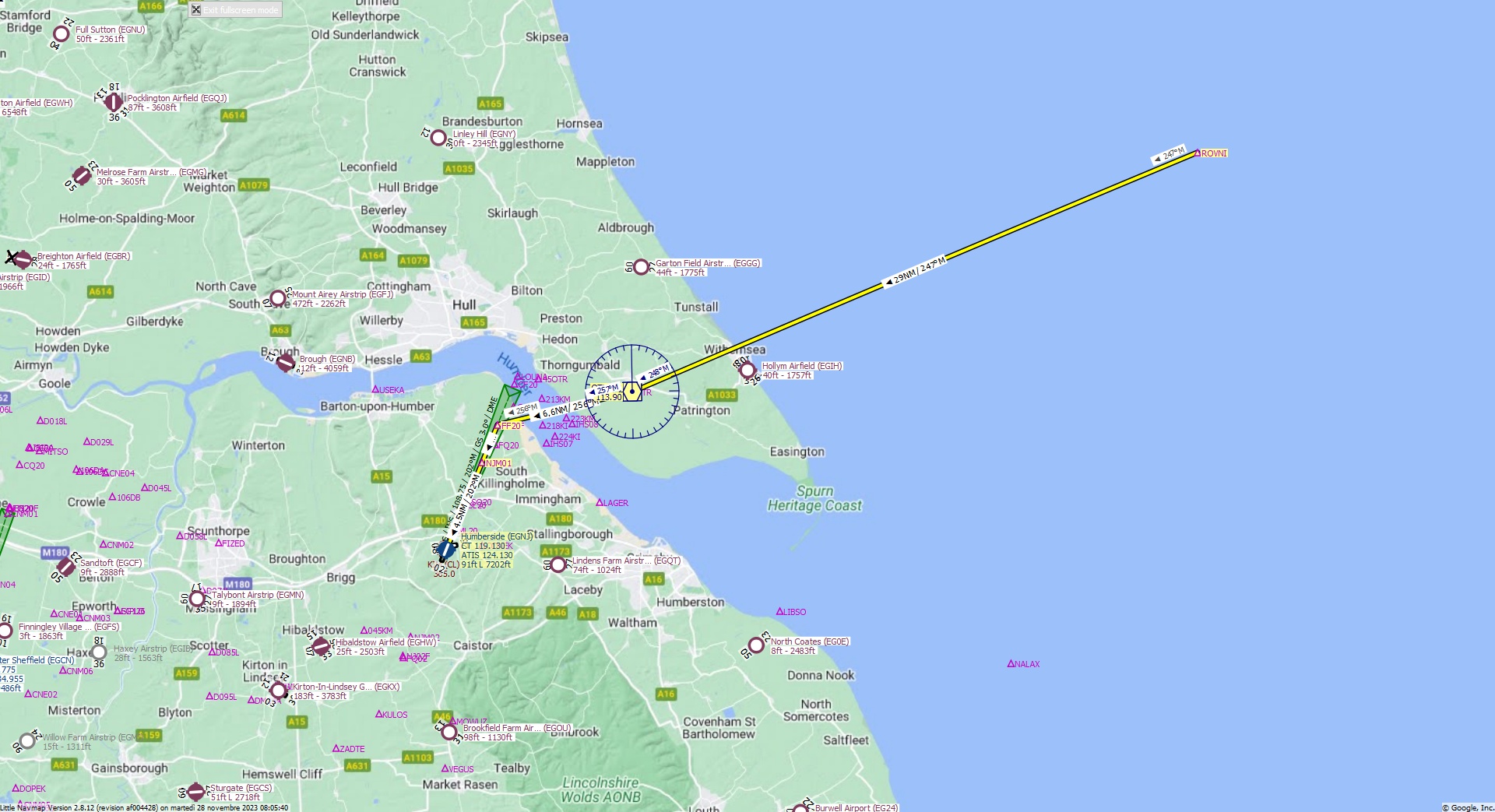
Cruising altitude 7.000 ft.
Distance 42 NM.
Clearance: British Landor 3 1 0, you are cleared for Humberside runway 20 approach. Fly inbound OTR VOR on the radial 2 4 7. At Ottringham VOR turn heading 2 5 6 and continue to FF20 FIX. Maintain 7000 feet.
Flight Plan Remarks
| FS Approaches UK Airports EGHJ - Humberside Aircraft: Airbus A310 City: Humberside Elevation: 91 ft Magnetic declination: 0° East Runway 20 Size: 7.202 x 142 ft Surface: Asphalt Pattern Altitude: 1.000 ft Edge Lights: High Center Lights: Low Runway Markings: Edges, Threshold, Fixed Distance, Touchdown, Dashes, Ident, Precision, Alternate Threshold, Alternate Fixed Distance, Alternate Touchdown |
| Ident | Name | Course °M |
Distance NM |
Remarks | Remaining NM |
Leg Time hh:mm |
Procedure | ETA hh:mm |
Region | Airway or Procedure |
Restriction ft/kts/angle |
Type | Freq. MHz/kHz/Cha. |
Range NM |
Course °T |
Fuel Rem. lbs |
Fuel Rem. gal |
Wind °M/kts |
Head- or Tailwind kts |
Altitude ft |
Leg Safe Alt. ft |
Latitude | Longitude | Related Ident/Freq./Dist./Bearing |
|
|---|---|---|---|---|---|---|---|---|---|---|---|---|---|---|---|---|---|---|---|---|---|---|---|---|---|
| ROVNI | 0,0 | 42 | Departure | EG | 53° 53' 13,00" N | 0° 39' 1,02" E | |||||||||||||||||||
| OTR | Ottringham | 247 | 29 | 13,0 | EG | VORDME (H) | 113,90 | 195 | 247 | 53° 41' 53,56" N | 0° 6' 13,48" W | ||||||||||||||
| FF20 | 256 | 6,6 | 6,4 | EG | 256 | 53° 40' 20,36" N | 0° 16' 58,82" W | ||||||||||||||||||
| NJM01 | 202 | 2,0 | 4,5 | EG | 202 | 53° 38' 32,14" N | 0° 18' 13,63" W | ||||||||||||||||||
| EGNJ | Humberside | 202 | 4,5 | 310 | 0,0 | Destination | EG | 202 | 53° 34' 24,00" N | 0° 21' 5,02" W |
| Links |