°M
NM
NM
hh:mm
hh:mm
Procedure
ft/kts/angle
MHz/kHz/Cha.
NM
°T
lbs
gal
°M/kts
kts
ft
ft
Ident/Freq./Dist./Bearing
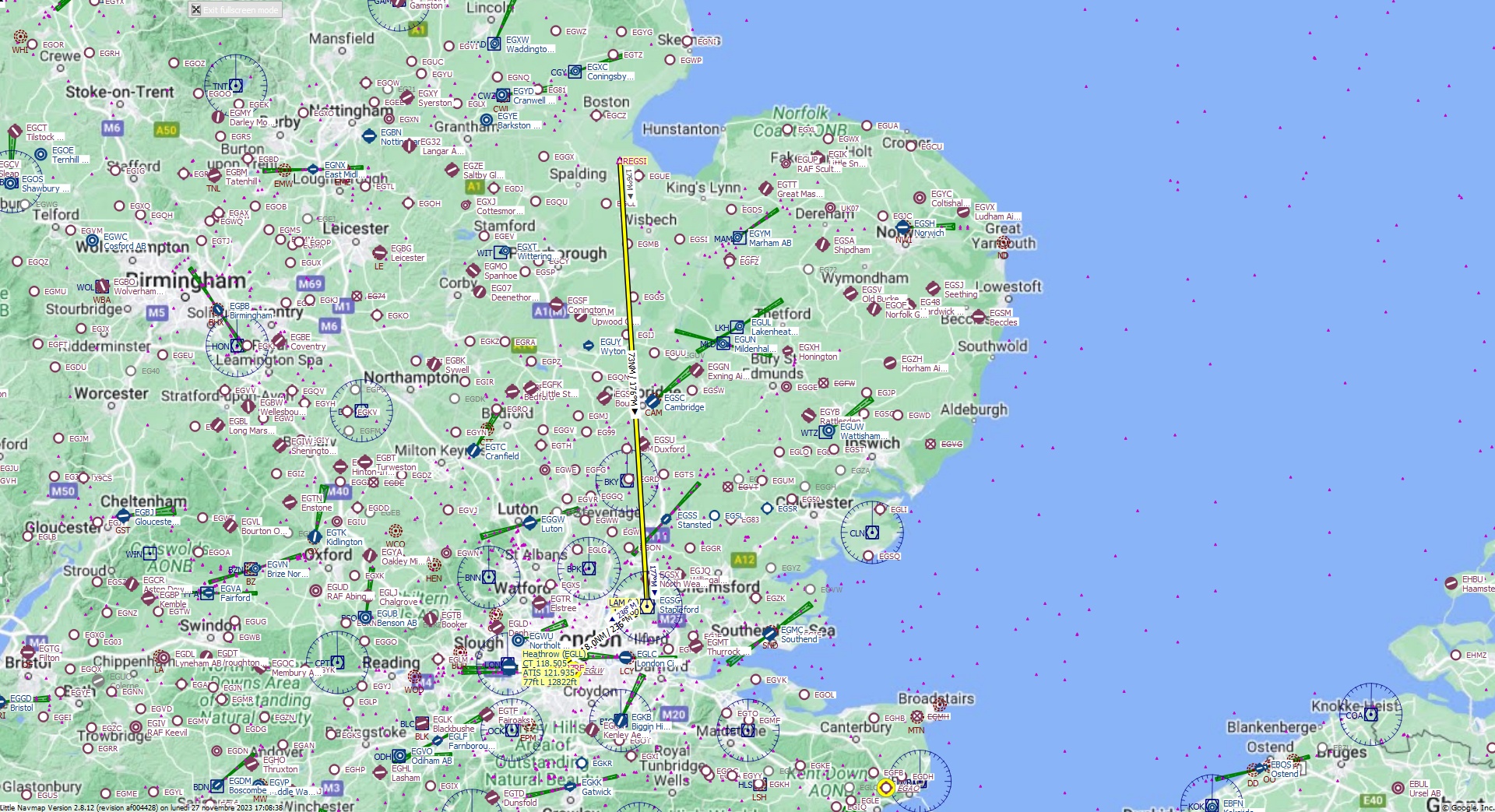
Cruising altitude 30.000 ft.
Distance 99 NM.
Clearance: British Boeing 7 4 7 heavy, you are cleared for Heathrow runway 27 Right approach. Fly inbound LAM VOR on the radial 1 7 6. On top Lambourne VOR continue to L27RF Fix heading 2 3 6. Maintain Flight Level 3 0 0.
Flight Plan Remarks
| FS Approaches UK Airports EGLL - Heathrow Aircraft: Boeing 747-8 City: London Elevation: 77 ft Magnetic declination: 0,2° East Runway 27R Size: 12.822 x 163 ft Surface: Asphalt Pattern Altitude: 1.000 ft Edge Lights: High Center Lights: High Has red Center Lights Runway Markings: Threshold, Fixed Distance, Dashes, Ident, Precision, Edge Pavement, Alternate Touchdown |
| Ident | Name | Course °M |
Distance NM |
Remarks | Remaining NM |
Leg Time hh:mm |
Procedure | ETA hh:mm |
Region | Airway or Procedure |
Restriction ft/kts/angle |
Type | Freq. MHz/kHz/Cha. |
Range NM |
Course °T |
Fuel Rem. lbs |
Fuel Rem. gal |
Wind °M/kts |
Head- or Tailwind kts |
Altitude ft |
Leg Safe Alt. ft |
Latitude | Longitude | Related Ident/Freq./Dist./Bearing |
|
|---|---|---|---|---|---|---|---|---|---|---|---|---|---|---|---|---|---|---|---|---|---|---|---|---|---|
| REGSI | 0,0 | 99 | Departure | EG | 52° 51' 19,00" N | 0° 1' 50,96" E | |||||||||||||||||||
| LAM | Lambourne | 176 | 73 | 26 | EG | VORDME (H) | 115,60 | 195 | 176 | 51° 38' 45,70" N | 0° 9' 6,13" E | ||||||||||||||
| L27RF | 236 | 18,0 | 8,0 | EG | 236 | 51° 28' 41,21" N | 0° 14' 49,62" W | ||||||||||||||||||
| EGLL | Heathrow | 270 | 8,0 | 747 | 0,0 | Destination | EG | 270 | 51° 28' 39,00" N | 0° 27' 40,97" W |
| Links |
AirNav.com, ChartFox (needs login), FltPlan, FlightAware, OpenNav, SkyVector |