°M
NM
NM
hh:mm
hh:mm
Procedure
ft/kts/angle
MHz/kHz/Cha.
NM
°T
lbs
gal
°M/kts
kts
ft
ft
Ident/Freq./Dist./Bearing
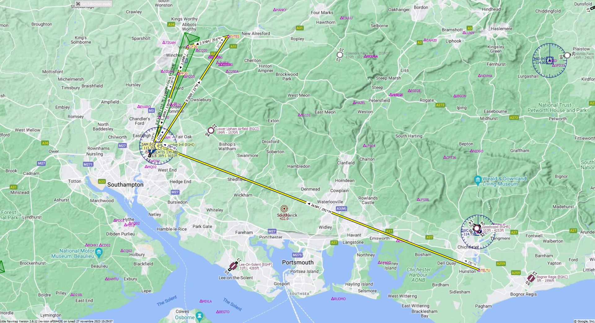
Cruising altitude 14.000 ft.
Distance 44 NM.
Clearance: Bonanza Golf 36, you are cleared for Southampton Inernational runway 20 approach. Fly inbound SAM VOR on the radial 2 9 1. At Southampton VOR turn right heading 0 3 3 to EVTES FIX. At EVTES make a left turn and align with runway 20.
Flight Plan Remarks
| FS Approaches UK Airports EGHI - Southampton Intl Aircraft: Bonanza G36 City: Southampton Elevation: 38 ft Magnetic declination: 0° Runway 20 Size: 5.651 x 117 ft Surface: Asphalt Pattern Altitude: 1.000 ft Edge Lights: High Center Lights: Low Has red Center Lights Runway Markings: Edges, Threshold, Fixed Distance, Touchdown, Dashes, Ident, Precision, Alternate Fixed Distance, Alternate Touchdown |
| Ident | Name | Course °M |
Distance NM |
Remarks | Remaining NM |
Leg Time hh:mm |
Procedure | ETA hh:mm |
Region | Airway or Procedure |
Restriction ft/kts/angle |
Type | Freq. MHz/kHz/Cha. |
Range NM |
Course °T |
Fuel Rem. lbs |
Fuel Rem. gal |
Wind °M/kts |
Head- or Tailwind kts |
Altitude ft |
Leg Safe Alt. ft |
Latitude | Longitude | Related Ident/Freq./Dist./Bearing |
|
|---|---|---|---|---|---|---|---|---|---|---|---|---|---|---|---|---|---|---|---|---|---|---|---|---|---|
| TELTU | 0,0 | 44 | Departure | EG | 50° 48' 40,00" N | 0° 45' 17,96" W | |||||||||||||||||||
| SAM | Southampton | 291 | 24 | 19,6 | EG | VORDME (H) | 113,35 | 195 | 291 | 50° 57' 18,90" N | 1° 20' 42,17" W | ||||||||||||||
| EVTES | 33 | 9,0 | 10,5 | EG | 33 | 51° 4' 55,00" N | 1° 12' 57,01" W | ||||||||||||||||||
| CF20 | 256 | 2,9 | 7,6 | EG | 256 | 51° 4' 13,23" N | 1° 17' 25,07" W | ||||||||||||||||||
| FF20 | 199 | 2,0 | 5,6 | EG | 199 | 51° 2' 20,10" N | 1° 18' 27,81" W | ||||||||||||||||||
| EGHI | Southampton Intl | 199 | 5,6 | G36 | 0,0 | Destination | EG | 199 | 50° 57' 0,99" N | 1° 21' 24,03" W |
| Links |