°M
NM
NM
hh:mm
hh:mm
Procedure
ft/kts/angle
MHz/kHz/Cha.
NM
°T
lbs
gal
°M/kts
kts
ft
ft
Ident/Freq./Dist./Bearing
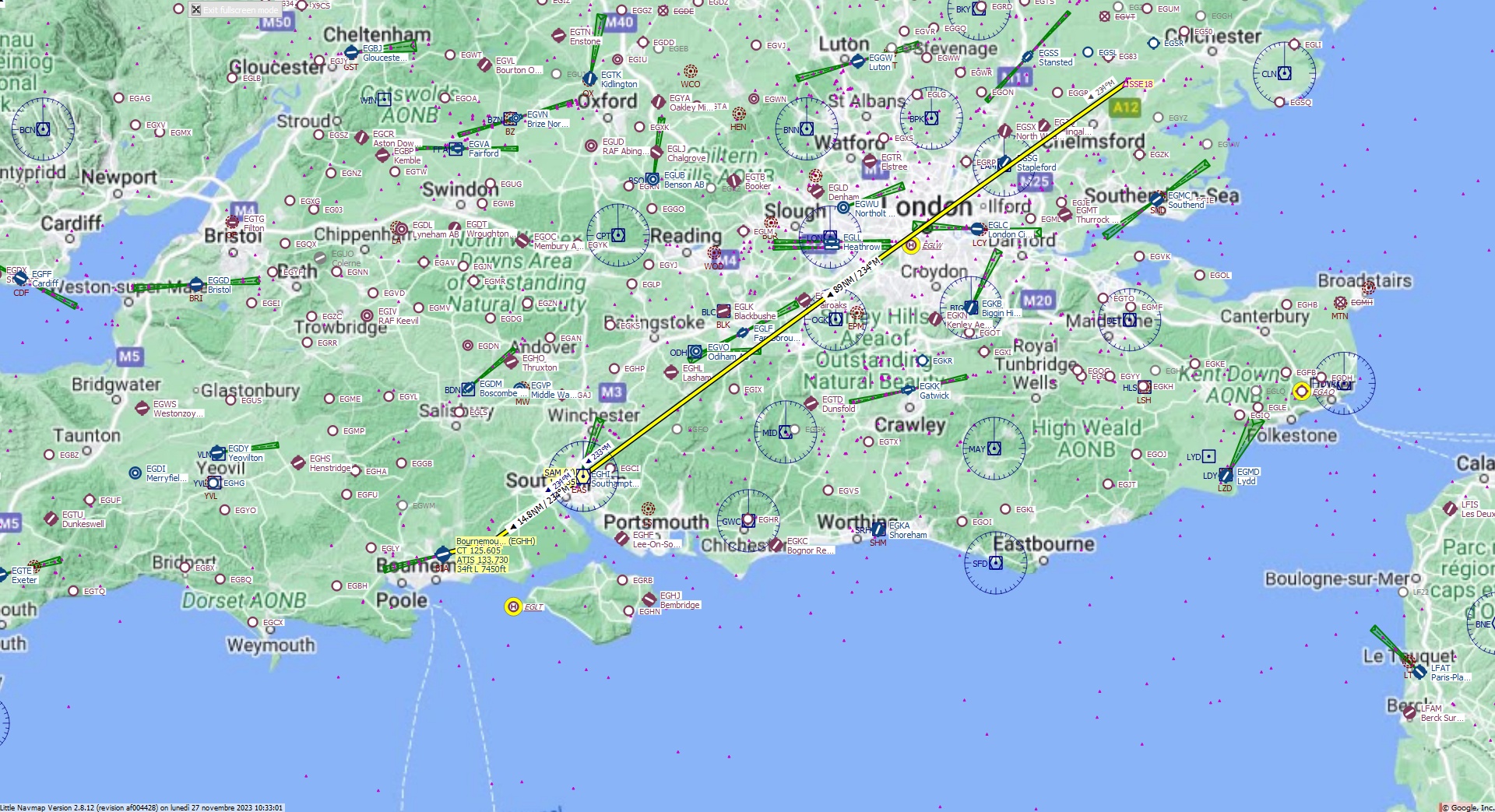
Cruising altitude 34.000 ft.
Distance 111 NM.
Clearance: Citation Charlie Juliet, you are cleared for Bournermouth runway 26 approach. Fly inbound SAM VOR on the radial 2 3 4. At Southampton VOR set heading 2 3 4 to CF26 FIX and align with runway 26. Descend to Flight Level 3 4 0.
Flight Plan Remarks
| FS Approaches UK Airports EGHH - Bournermouth Aircraft: Citation CJ4 City: St Just Elevation: 34 ft Magnetic declination: 0,1° West Runway 26 Size: 7.450 x 148 ft Surface: Bituminous Pattern Altitude: 1.000 ft Edge Lights: High Center Lights: Medium Has red Center Lights Runway Markings: Edges, Threshold, Touchdown, Dashes, Ident, Precision, Alternate Touchdown |
| Ident | Name | Course °M |
Distance NM |
Remarks | Remaining NM |
Leg Time hh:mm |
Procedure | ETA hh:mm |
Region | Airway or Procedure |
Restriction ft/kts/angle |
Type | Freq. MHz/kHz/Cha. |
Range NM |
Course °T |
Fuel Rem. lbs |
Fuel Rem. gal |
Wind °M/kts |
Head- or Tailwind kts |
Altitude ft |
Leg Safe Alt. ft |
Latitude | Longitude | Related Ident/Freq./Dist./Bearing |
|
|---|---|---|---|---|---|---|---|---|---|---|---|---|---|---|---|---|---|---|---|---|---|---|---|---|---|
| SSE18 | 0,0 | 111 | Departure | EG | 51° 49' 37,86" N | 0° 35' 2,89" E | |||||||||||||||||||
| SAM | Southampton | 234 | 89 | 22 | EG | VORDME (H) | 113,35 | 195 | 235 | 50° 57' 18,90" N | 1° 20' 42,17" W | ||||||||||||||
| CF26 | 234 | 14,8 | 7,1 | EG | 234 | 50° 48' 38,06" N | 1° 39' 43,04" W | ||||||||||||||||||
| FF26 | 255 | 2,0 | 5,1 | EG | 255 | 50° 48' 7,34" N | 1° 42' 45,86" W | ||||||||||||||||||
| EGHH | Bournemouth | 255 | 5,1 | CJ4 | 0,0 | Destination | EG | 255 | 50° 46' 48,00" N | 1° 50' 33,00" W |
| Links |