°M
NM
NM
hh:mm
hh:mm
Procedure
ft/kts/angle
MHz/kHz/Cha.
NM
°T
lbs
gal
°M/kts
kts
ft
ft
Ident/Freq./Dist./Bearing
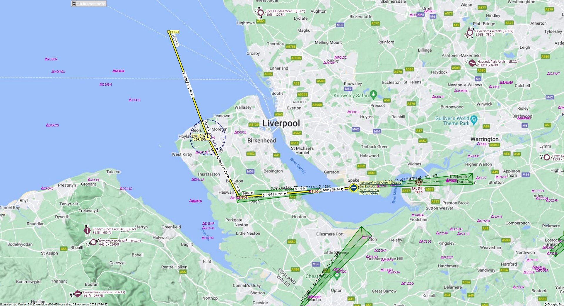
Cruising altitude 5.000 ft.
Distance 21 NM.
Clearance: British Airways 3 1 0, you are cleared for John Lennon Airport runway 09 approach. Fly inbound WAL VOR on the radial 1 6 1 then continue outbound heading 1 5 3 to FF09 fix. Maintain 5000 feet.
Flight Plan Remarks
| FS Approaches UK Airports EGGP - John Lennon Airport Aircraft: Airbus A310 City: Liverpool Elevation: 77 ft Magnetic declination: 0,6° West Runway 09 Size: 7.494 x 151 ft Surface: Asphalt Pattern Altitude: 1.000 ft Edge Lights: High Center Lights: Medium Has red Center Lights Runway Markings: Edges, Threshold, Fixed Distance, Touchdown, Dashes, Ident, Precision, Alternate Fixed Distance, Alternate Touchdown |
| Ident | Name | Course °M |
Distance NM |
Remarks | Remaining NM |
Leg Time hh:mm |
Procedure | ETA hh:mm |
Region | Airway or Procedure |
Restriction ft/kts/angle |
Type | Freq. MHz/kHz/Cha. |
Range NM |
Course °T |
Fuel Rem. lbs |
Fuel Rem. gal |
Wind °M/kts |
Head- or Tailwind kts |
Altitude ft |
Leg Safe Alt. ft |
Latitude | Longitude | Related Ident/Freq./Dist./Bearing |
|
|---|---|---|---|---|---|---|---|---|---|---|---|---|---|---|---|---|---|---|---|---|---|---|---|---|---|
| GPLV1 | 0,0 | 21 | Departure | 53° 30' 51,39" N | 3° 12' 35,65" W | ||||||||||||||||||||
| WAL | Wallasey | 161 | 7,8 | 12,7 | EG | VORDME (H) | 114,10 | 195 | 160 | 53° 23' 30,96" N | 3° 8' 4,06" W | ||||||||||||||
| FF09 | 153 | 4,7 | 8,0 | EG | 152 | 53° 19' 21,25" N | 3° 4' 25,54" W | ||||||||||||||||||
| SL09 | 86 | 5,0 | 3,0 | EG | 85 | 53° 19' 45,95" N | 2° 56' 6,98" W | ||||||||||||||||||
| EGGP | Liverpool John Lennon Airport | 86 | 3,0 | 310 | 0,0 | Destination | EG | 85 | 53° 20' 0,89" N | 2° 51' 4,36" W |
| Links |