°M
NM
hh:mm
hh:mm
Procedure
ft/kts/angle
MHz/kHz/Cha.
NM
°T
NM
lbs
gal
°M/kts
kts
ft
ft
Ident/Freq./Dist./Bearing
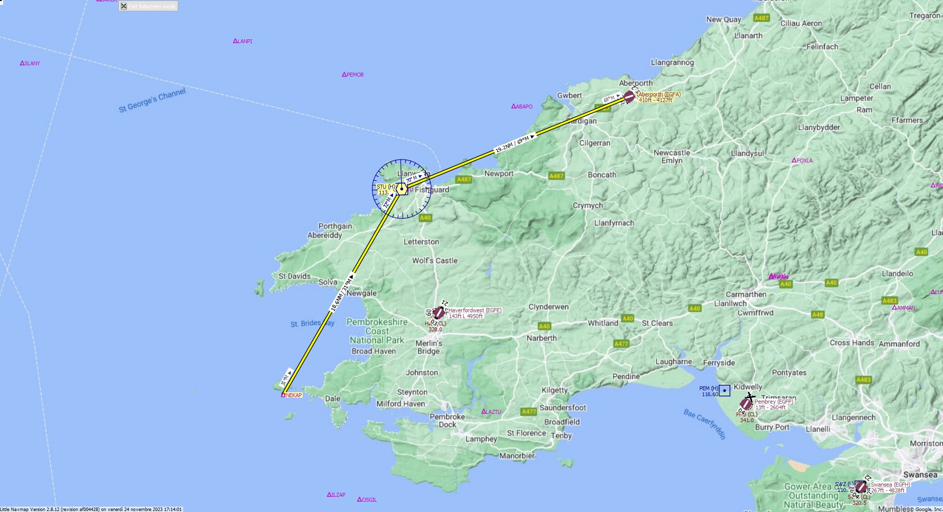
Cruising altitude 12.000 ft.
Distance 38 NM.
Clearance: Bonanza Golf 36, you are cleared for Aberporth runway 07 approach. Fly and track STU VOR inbound. Then continue outbound on the radial 2 9 1. Descend to 12000 feet.
Flight Plan Remarks
| FS Approaches UK Airports EGFA - Aberporth Aircraft: Bonanza G36 City: Aberporth Elevation: 410 ft Magnetic declination: 1,2° West Runway 07 Size: 4.127 x 99 ft Surface: Bituminous Pattern Altitude: 1.000 ft Runway Markings: Dashes, Ident |
| Ident | Name | Course °M |
Distance NM |
Remarks | Leg Time hh:mm |
Procedure | ETA hh:mm |
Region | Airway or Procedure |
Restriction ft/kts/angle |
Type | Freq. MHz/kHz/Cha. |
Range NM |
Course °T |
Remaining NM |
Fuel Rem. lbs |
Fuel Rem. gal |
Wind °M/kts |
Head- or Tailwind kts |
Altitude ft |
Leg Safe Alt. ft |
Latitude | Longitude | Related Ident/Freq./Dist./Bearing |
|
|---|---|---|---|---|---|---|---|---|---|---|---|---|---|---|---|---|---|---|---|---|---|---|---|---|---|
| NEKAP | 0,0 | Departure | EG | 38 | 51° 43' 35,01" N | 5° 17' 26,01" W | |||||||||||||||||||
| STU | Strumble | 31 | 18,6 | EG | VORDME (H) | 113,10 | 195 | 30 | 19,2 | 51° 59' 40,88" N | 5° 2' 24,69" W | ||||||||||||||
| EGFA | Aberporth | 69 | 19,2 | G36 | Destination | 68 | 0,0 | 52° 6' 53,00" N | 4° 33' 34,01" W |
| Links |