°M
NM
hh:mm
hh:mm
Procedure
ft/kts/angle
MHz/kHz/Cha.
NM
°T
NM
lbs
gal
°M/kts
kts
ft
ft
Ident/Freq./Dist./Bearing
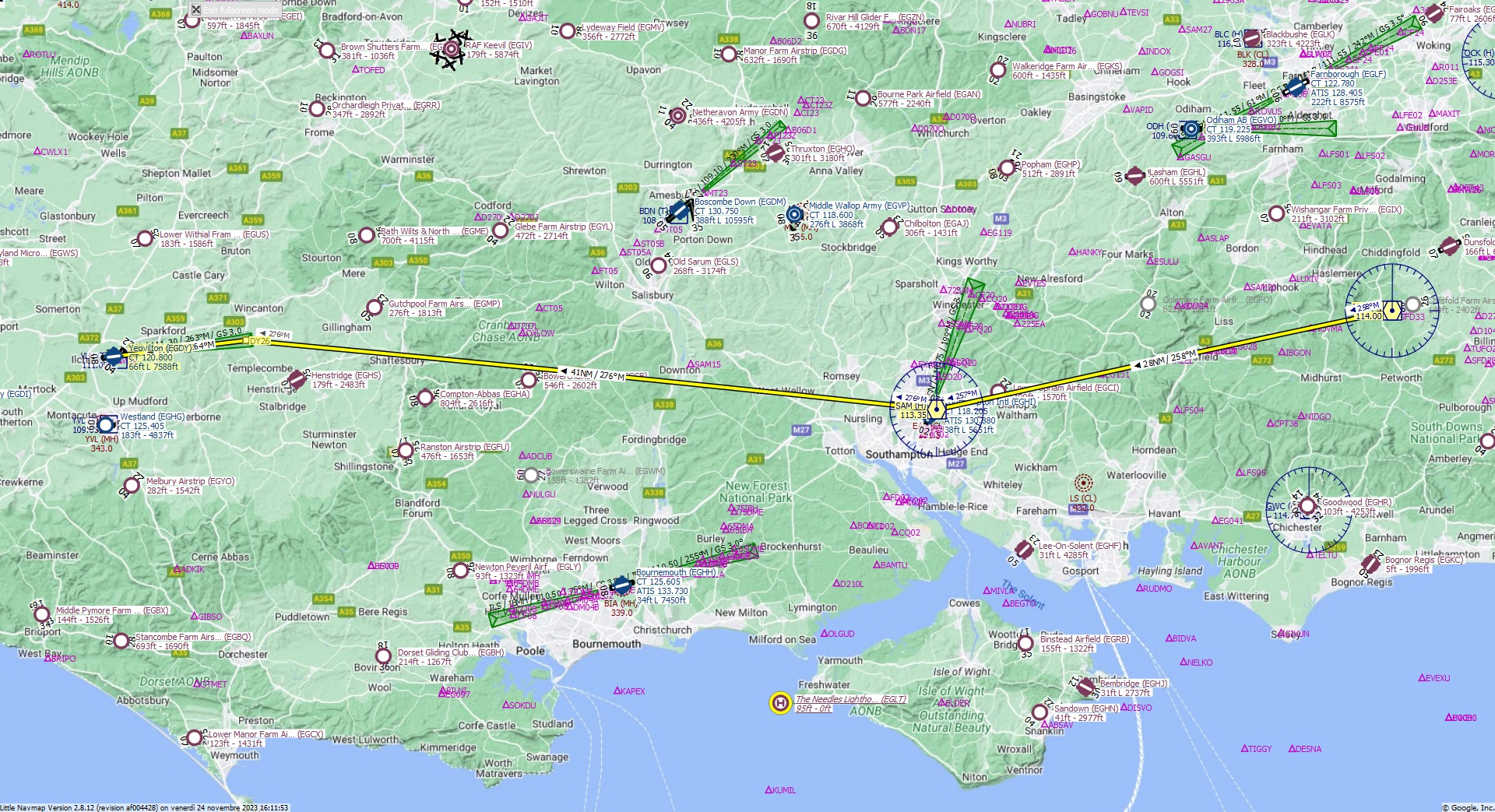
Cruising altitude 24.000 ft.
Distance 77 NM.
Cearance: British 3 2 0, you are cleared for Yeovilton runway 26 approach. Fly inbound SAM VOR on the radial 2 5 8. At Southampton VOR, turn heading 2 7 6. Descend to flight Level 2 4 0.
Flight Plan Remarks
| FS Approaches UK Airports EGDY - Yeovilton Aircraft: Airbus A320 City: Yeovilton Elevation: 66 ft Magnetic declination: 0,3° West Runway 26 Size: 7.588 x 151 ft Surface: Asphalt Pattern Altitude: 1.000 ft Edge Lights: High Runway Markings: Threshold, Dashes, Ident |
| Ident | Name | Course °M |
Distance NM |
Remarks | Leg Time hh:mm |
Procedure | ETA hh:mm |
Region | Airway or Procedure |
Restriction ft/kts/angle |
Type | Freq. MHz/kHz/Cha. |
Range NM |
Course °T |
Remaining NM |
Fuel Rem. lbs |
Fuel Rem. gal |
Wind °M/kts |
Head- or Tailwind kts |
Altitude ft |
Leg Safe Alt. ft |
Latitude | Longitude | Related Ident/Freq./Dist./Bearing |
|
|---|---|---|---|---|---|---|---|---|---|---|---|---|---|---|---|---|---|---|---|---|---|---|---|---|---|
| MID | Midhurst | 0,0 | Departure | EG | VORDME (H) | 114,00 | 195 | 77 | 51° 3' 14,22" N | 0° 37' 30,00" W | |||||||||||||||
| SAM | Southampton | 258 | 28 | EG | VORDME (H) | 113,35 | 195 | 258 | 49 | 50° 57' 18,90" N | 1° 20' 42,17" W | ||||||||||||||
| DY26 | 276 | 41 | 276 | 7,9 | 51° 1' 26,98" N | 2° 26' 13,75" W | |||||||||||||||||||
| EGDY | Yeovilton | 264 | 7,9 | 320 | Destination | 263 | 0,0 | 51° 0' 29,77" N | 2° 38' 43,77" W |
| Links |