°M
NM
hh:mm
hh:mm
Procedure
ft/kts/angle
MHz/kHz/Cha.
NM
°T
NM
lbs
gal
°M/kts
kts
ft
ft
Ident/Freq./Dist./Bearing
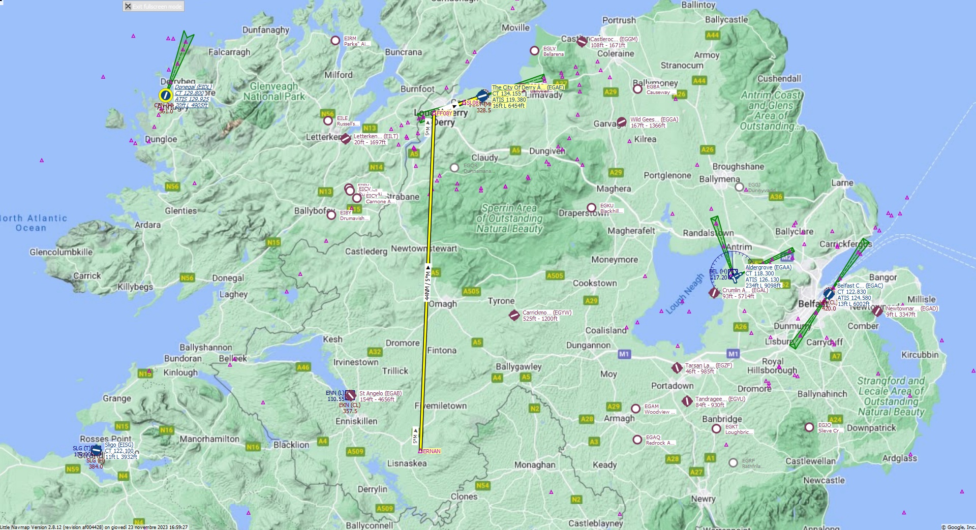
Cruising altitude 13.000 ft.
Distance 50 NM.
Clearance: Bonanza Golf 36, you are cleared for The City of Derry runway 08 approach. Descend to 13000 feet and set heading to 005 to FF08Y Fix. At FF08Y turn right to align with runway 08.
Flight Plan Remarks
| EGAC - The City of Derry Aircraft: Bonanza G36 City: Derry Elevation: 16 ft Magnetic declination: 3° West Runway 08 Size: 6.454 x 142 ft Surface: Asphalt Pattern Altitude: 1.000 ft Edge Lights: High Center Lights: Low Runway Markings: Edges, Threshold, Fixed Distance, Touchdown, Dashes, Ident, Precision, Alternate Fixed Distance, Alternate Touchdown |
| Ident | Name | Course °M |
Distance NM |
Remarks | Leg Time hh:mm |
Procedure | ETA hh:mm |
Region | Airway or Procedure |
Restriction ft/kts/angle |
Type | Freq. MHz/kHz/Cha. |
Range NM |
Course °T |
Remaining NM |
Fuel Rem. lbs |
Fuel Rem. gal |
Wind °M/kts |
Head- or Tailwind kts |
Altitude ft |
Leg Safe Alt. ft |
Latitude | Longitude | Related Ident/Freq./Dist./Bearing |
|
|---|---|---|---|---|---|---|---|---|---|---|---|---|---|---|---|---|---|---|---|---|---|---|---|---|---|
| ERNAN | 0,0 | Departure | EI | 50 | 54° 16' 43,90" N | 7° 23' 33,94" W | |||||||||||||||||||
| FF08Y | 5 | 44 | EG | 2 | 6,6 | 55° 0' 23,58" N | 7° 20' 31,13" W | ||||||||||||||||||
| SL08 | 73 | 4,1 | EG | 70 | 2,5 | 55° 1' 46,40" N | 7° 13' 48,86" W | ||||||||||||||||||
| EGAE | The City Of Derry Airport | 74 | 2,5 | G36 | Destination | EG | 71 | 0,0 | 55° 2' 34,00" N | 7° 9' 42,99" W |
| Links |