°M
NM
hh:mm
hh:mm
Procedure
ft/kts/angle
MHz/kHz/Cha.
NM
°T
NM
lbs
gal
°M/kts
kts
ft
ft
Ident/Freq./Dist./Bearing
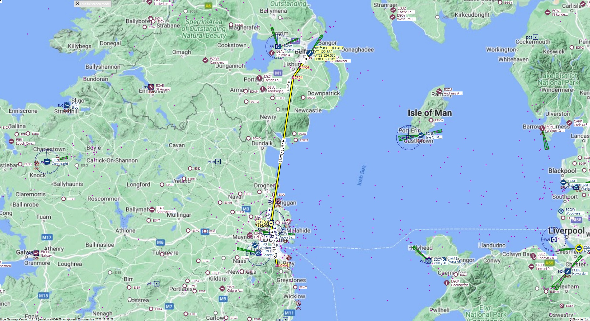
Cruising altitude 27.000 ft.
Distance 87 NM.
Clearance: Airbus 3 2 0, you are cleared for George Best runway 04 approach. Maintain current heading and descend to Flight Level 2 7 0. Pass Dublin VOR and continue heading 0 1 1 to CF04 Fix.
Flight Plan Remarks
| EGAC - George Best Belfast City Aircraft: Cessna Citation CJ4 City: Belfast Elevation: 13 ft Magnetic declination: 2,1° West Runway 04 Size: 6.002 x 146 ft Surface: Asphalt Pattern Altitude: 1.000 ft Edge Lights: High Center Lights: Low Has red Center Lights Runway Markings: Edges, Threshold, Fixed Distance, Touchdown, Dashes, Ident, Precision, Alternate Touchdown |
| Ident | Name | Course °M |
Distance NM |
Remarks | Leg Time hh:mm |
Procedure | ETA hh:mm |
Region | Airway or Procedure |
Restriction ft/kts/angle |
Type | Freq. MHz/kHz/Cha. |
Range NM |
Course °T |
Remaining NM |
Fuel Rem. lbs |
Fuel Rem. gal |
Wind °M/kts |
Head- or Tailwind kts |
Altitude ft |
Leg Safe Alt. ft |
Latitude | Longitude | Related Ident/Freq./Dist./Bearing |
|
|---|---|---|---|---|---|---|---|---|---|---|---|---|---|---|---|---|---|---|---|---|---|---|---|---|---|
| KOMAL | 0,0 | Departure | EI | 87 | 53° 13' 6,99" N | 6° 14' 27,97" W | |||||||||||||||||||
| DUB | Dublin | 354 | 17,0 | EI | VORDME (T) | 114,90 | 38 | 352 | 70 | 53° 29' 57,80" N | 6° 18' 25,61" W | ||||||||||||||
| CF04 | 11 | 58 | EG | 9 | 11,4 | 54° 27' 41,97" N | 6° 3' 32,86" W | ||||||||||||||||||
| FF04 | 37 | 4,9 | EG | 35 | 6,5 | 54° 31' 43,27" N | 5° 58' 45,90" W | ||||||||||||||||||
| EGAC | Belfast City | 37 | 6,5 | Destination | EG | 35 | 0,0 | 54° 37' 5,01" N | 5° 52' 21,05" W |
| Links |