°M
NM
hh:mm
hh:mm
Procedure
ft/kts/angle
MHz/kHz/Cha.
NM
°T
NM
lbs
gal
°M/kts
kts
ft
ft
Ident/Freq./Dist./Bearing
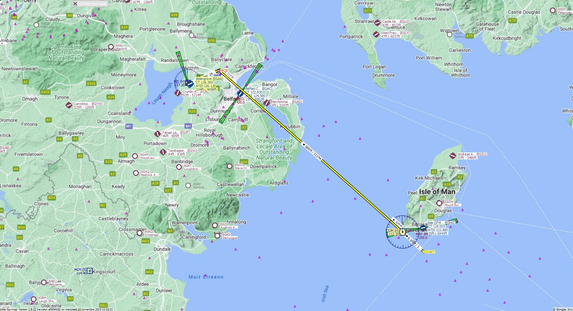
Cruising altitude 22.000 ft.
Distance 73 NM.
Clearance
Airbus 3 2 0 you are cleared for Aldergrove runway 25 approach. Descend to Flight Level 2 2 0. Fly heading 3 1 5. Pass the IOM VOR and set heading 3 1 3 to FF25 Fix
Flight Plan Remarks
| FS Approaches UK Airports EGAA - Aldergrove Aircraft: Airbus A320 City: Belfast Elevation: 234 ft Magnetic declination: 2,4° West Runway 25 Size: 9.098 x 145 ft Surface: Asphalt Pattern Altitude: 1.000 ft Edge Lights: High Center Lights: Low Runway Markings: Threshold, Touchdown, Dashes, Ident, Precision, Alternate Threshold, Alternate Touchdown |
| Ident | Name | Course °M |
Distance NM |
Remarks | Leg Time hh:mm |
Procedure | ETA hh:mm |
Region | Airway or Procedure |
Restriction ft/kts/angle |
Type | Freq. MHz/kHz/Cha. |
Range NM |
Course °T |
Remaining NM |
Fuel Rem. lbs |
Fuel Rem. gal |
Wind °M/kts |
Head- or Tailwind kts |
Altitude ft |
Leg Safe Alt. ft |
Latitude | Longitude | Related Ident/Freq./Dist./Bearing |
|
|---|---|---|---|---|---|---|---|---|---|---|---|---|---|---|---|---|---|---|---|---|---|---|---|---|---|
| START | 0,0 | Departure | 73 | 53° 59' 15,18" N | 4° 37' 14,21" W | ||||||||||||||||||||
| IOM | Isle Of Man | 315 | 6,9 | EG | VORDME (H) | 112,20 | 195 | 313 | 66 | 54° 4' 0,72" N | 4° 45' 48,50" W | ||||||||||||||
| FF25 | 313 | 58 | EG | 312 | 7,5 | 54° 42' 38,95" N | 6° 1' 9,82" W | ||||||||||||||||||
| EGAA | Aldergrove | 247 | 7,5 | Destination | EG | 245 | 0,0 | 54° 39' 27,00" N | 6° 12' 57,01" W |
| Links |